Arlington, Virginia · Near Ballston and Virginia Square
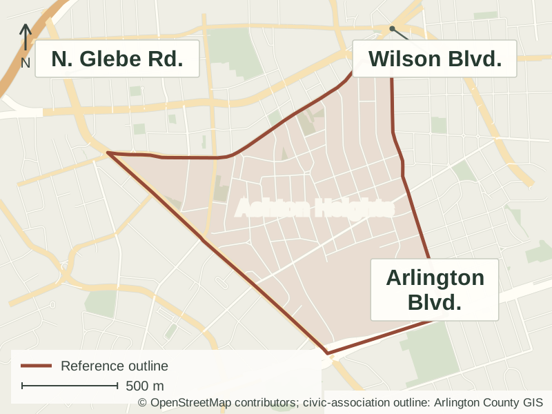
Ashton Heights is an Arlington neighborhood between the Wilson Boulevard corridor and Arlington Boulevard, with narrow residential streets and mature shade trees. Its houses span several early and mid-twentieth-century styles, including bungalows, Cape Cods, Tudors and American Foursquares. Development by many builders over several decades produced a varied historic district rather than a neighborhood of matching houses.
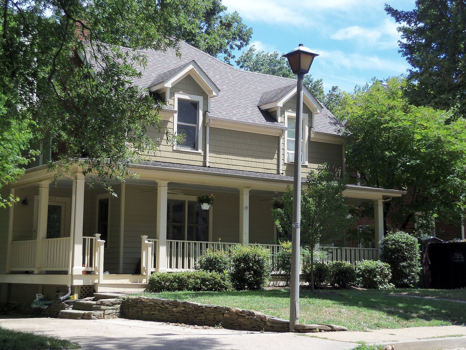
A house with a wraparound porch in the Ashton Heights Historic District.Photo: Farragutful · CC BY-SA 3.0 · Resized and compressed for the web; page layouts may crop the display.
The neighborhood and its streets
Ashton Heights developed from 1921 through the mid-twentieth century as commuter transportation and federal employment supported new housing in Arlington. Its historic district comprises 23 separate divisions built by 18 developers, which helps explain the variety of house forms and street settings.
The neighborhood is predominantly residential, with mature shade trees and narrow streets between the Wilson Boulevard corridor and Arlington Boulevard. Nearby Central Library and Quincy Park provide public resources, while the Ashton Heights Civic Association organizes neighborhood information, newsletters and meetings.
Houses and architectural styles
The historic district includes Craftsman bungalows, Cape Cods, Colonial Revival and Tudor Revival houses, American Foursquares and apartment buildings. Construction over several decades produced a range of house forms and building styles.
Researching an Ashton Heights address
An individual house can tell a different story from the neighborhood as a whole. These county resources help connect the older houses and tree-lined streets described here with records and maps for a particular location.
Earlier construction and alterations
Arlington's historic-property research guide explains how to combine assessment records, old permits, photographs and maps. Its Historical House Cards collection can help trace a home's construction, alterations and former addresses.
The county's map directory links a Tree Canopy Dashboard with civic-association statistics for 2014–2023, along with imagery and other reference maps. The dated survey information offers a way to examine Ashton Heights' tree cover.
The historic district comprises 23 separate divisions built by 18 developers. Its development extended over several decades, helping explain why its houses reflect different architectural periods rather than one uniform plan.
Clarendon School opened in 1910 and was renamed Matthew Maury School in 1944. Richmond architect Charles M. Robinson designed its brick Classical Revival building, including Palladian windows and a columned wooden portico.
Nearby Quincy Park’s playground includes tactile, visual, auditory, spinning and movement experiences for children with different abilities. Sports courts and playing fields occupy other parts of the park.
Yes. Ashton Heights is in Arlington County, between the Wilson Boulevard corridor and Arlington Boulevard. Its civic-association boundaries also follow portions of North 10th Street, North Irving Street and Glebe Road.
Is there a historic district?
Yes. The Ashton Heights Historic District was listed on the National Register of Historic Places in 2003.
Where is neighborhood news published?
The Ashton Heights Civic Association publishes newsletters and meeting records on its website.